In 1989, when land east of Hapa Trail was reclassified and zoned for development, a condition of the reclassification was to improve and maintain the Hapa Trail's alignment from Po'ipu Road to Koloa Town as a bike and pedestrian pathway for public use in perpetuity.
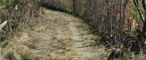 Portion of Hapa Trail -T Blake Photo
|
Hapa Trail has a unique cultural identity, history and strong environmental and sustainable practices that stand as an example for residents and visitors to improve their quality of life. The local community singled out Hapa Trail as the Koloa-Po'ipu Area Circulation Plan's flagship project.
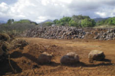 Rockpile for restoration of Hapa Trail walls -T Blake Photo
|
On August 8, 2007, the Koloa-Po'ipu Area Circulation Plan was gifted to the County of Kaua'i by the Koloa Community Association. The plan was created through input of local residents, developers, the County of Kaua'i and other stakeholders. The Circulation Plan connects communities and increases transportation and mobility options.
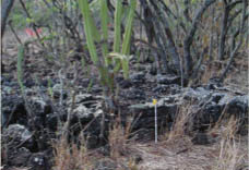 Kauhale site in the field system -Cultural Surveys Photo
|