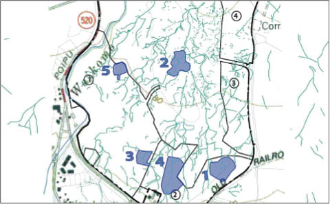
 Aerial drawing of Kiahuna Golf Course and its 'auwai system. The five indicated areas are the archaeological preserves today -Cultural Surveys Photo
|
Water was fed from the streams into 'auwai and lo'i, (taro patches).The water flowed by gravity from one loʻi to the next, feeding the crop of taro and fish that were raised with the taro.While laws concerning humans seemed to be at the whim of the ruling chief, laws concerning water, the kahawai (stream), were strict and permanent.
'Auwai were extensive, highly developed and carefully engineered water channels.'Auwai fed the upslope ends of the wet field systems in Koloa.These 'auwai varied in size but generally had the same construction features.
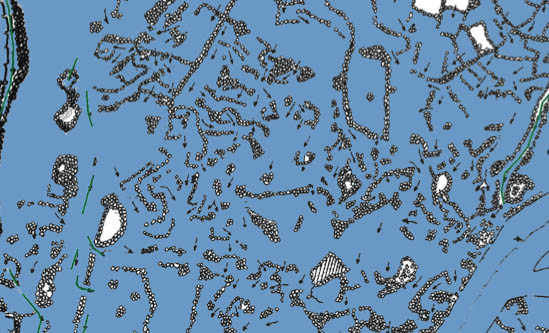
 'Auwai irrigating amongst rock outcropping -Cultural Surveys Photo
|
'Auwai flowed at ground level, underground through lava tubes and above ground in aqueducts. There are evidence of 'auwai flowing through homesites for household use.
'Auwai branched outwards and provided water for field complexes on either side of their course. They flowed following curving paths along natural slopes, across bedrock surfaces and parallel to pahoehoe outcrops, often with rock retaining walls.
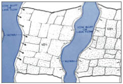
Portion of Kiahuna Golf Course with lo'i, water holding ponds and directional arrows indicating the flow of the 'auwai -Cultural Surveys Photo |
Channels branched off throughout the area in a dendritic fashion resembling an upside down tree, subdividing downslope to feed separate field complexes. Only when slope variations were uniform was their course straight.
This unique engineering feat is the exact reverse of the flow pattern of a typical stream in which water is collected in fewer streams of increasing volume downslope.
The effect of the 'auwai system is dispersed into more numerous, smaller channels downslope, similar to the pattern of a natural delta.
Within the water transport system, there were catchment basins serving as intermediate storage units of water. Catchment basins were low areas located adjacent to 'auwai and were used to retain water for short periods of time.
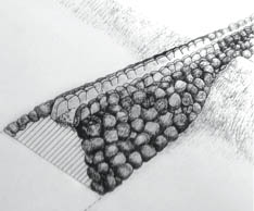 (Drawing of a raised 'auwai (aqueduct) -Cultural Surveys Photo)
|
Many 'auwai are still evident and some well preserved. The 'auwai system represents impressive manifestations of prehistoric Hawaiian achievements in hydrological engineering.